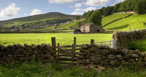
Britain is home to some of the best rambling opportunities in the world, and boasts some fantastic long distance trails. Take, for example, the Pennine Way, a 267 mile footpath running from the Derbyshire Peak District to the Northumberland National Park.
There are also two fantastic trails which follow the line of ancient fortifications. The first, Offa’s Dyke Path, is a 176 mile route which follows the remains of an 8th century Anglo-Saxon earthwork, once the demarcation line between the kingdom of Mercia and the Welsh kingdom of Powys.
Stretching 84 miles from Bowness-on-Solway to Newcastle-upon-Tyne is the Hadrian’s Wall Walk, a long distance trail following the line of Hadrian’s Wall, a fortification which once marked the northernmost extent of the Roman Empire.

Here at Historic UK, one of our favourite trails is the West Highland Way in Scotland, a 96 mile footpath leading from Glasgow to Fort William and covering some of the most scenic areas in the UK. The final stage of the walk also passes the foot of Ben Nevis, providing a great opportunity to climb the highest mountain in the British Isles.
Below is a list of Britain’s most popular long distance trails:
| Cleveland Way | 110 Miles | Circles the North York Moors National Park, from Helmsley to Filey. |
| Cotswolds Way | 101 miles | Passes south to north through the heart of the scenic Cotswold hills, from Bath to Chipping Campden. |
| Glyndŵr’s Way | 135 miles | Running in a horseshoe shape around the ancient kingdom of Powys, from Knighton to Welshpool. |
| Great Glen Way | 73 miles | A popular walk for those interested in Nessie spotting, this 79 mile route starts at Fort William and follows the edge of Loch Ness to Inverness. |
| Hadrian’s Wall Path | 84 miles | Follows the path of the ancient Roman fortification of Hadrian’s Wall, from Bowness-on-Solway to Wallsend in Newcastle-upon-Tyne. |
| North Downs Way | 153 miles | Passes through the rolling hills of the North Downs, from Farnham to Dover. |
| Offa’s Dyke Path | 177 miles | Follows the route of the ancient Anglo-Saxon earthwork of Offa’s Dyke, from the Severn Estuary to Prestatyn on the north coast of Wales. |
| Peddars Way & Norfolk Coastal Path | 93 miles | The first half of the trail, the Peddars Way, follows the route of an ancient Roman road from Knettishall Heath to Holme-next-the-Sea. At Holme the route then merges with the Norfolk Coast Path, ending at Cromer. |
| Pembrokeshire Coast Path | 185 miles | Passing through some of the most scenic coastal areas in Britain, the Pembrokeshire Coast Path runs from Amroth to St Dogmaels. |
| Pennine Bridleway | 119 miles | Follows old packhorse routes and drovers roads from Middleton-by-Wirksworth in Derbyshire to Hebden Bridge in West Yorkshire. |
| Pennine Way | 267 miles | One of the best known long distance trails in England, the Pennine Way crosses the Peak District, the Yorkshire Dales and the Northumberland National Park. |
| The Ridgeway | 86 miles | Follows the route of Britain’s oldest road from Avebury in Wiltshire through to Ivinghoe Beacon in Buckinghamshire. |
| Scottish National Trail | 470 miles | The longest and newest trail in the UK, the Scottish National Trail runs from Kirk Yetholm in the Scottish Borders to Cape Wrath in the north west Highlands. It utilises a series of established routes for the majority of its length. |
| Speyside Way | 81 miles | Follows the River Spey from Aviemore in the Grampian Mountains to Buckie on the Moray coast. |
| South Downs Way | 99 miles | This ancient pathway has been in use for some 8,000 years, and today runs from Winchester to Eastbourne on the East Sussex coastline. |
| South West Coast Path | 630 miles | The longest footpath in the UK, the South West Coast Path follows the coast from Minehead in Somerset, through Devon and Cornwall and ending at Poole Harbour in Dorset. |
| Southern Upland Way | 211 miles | Runs coast to coast from Portpatrick in Dumfries and Galloway to Cockburnspath in the Scottish Borders. |
| Thames Path | 183 miles | Following the path of the River Thames from Gloucestershire to East London, the majority of the Thames Path uses ancient towpaths along the riverbanks. |
| West Highland Way | 94 miles | The most famous long distance path in Scotland, the West Highlands Way runs through some of the most beautiful scenery in the country from Milngavie to Fort William. Also passes the foot of Ben Nevis. |
| Yorkshire Wolds Way | 79 miles | One of the lesser known long distance trails, the Yorkshire Wolds Way runs from the River Humber to Filey in North Yorkshire. |
Ordnance Survey Maps for Walking
The Ordnance Survey is hands down the most popular map publisher in the UK for outdoor pursuits. The detail of the maps is unrivalled, with historic sites, contours, footpaths and bridleways all being outlined.
The two most popular OS maps are the Landranger and the Explorer maps.
Landranger Maps
Set to a 1:50,000 scale, these maps are ideal for visitors looking to travel over a wide distance. However, due to their rather large scale, these maps aren’t the most popular with walkers and instead tend to be used for planning or for in-car use.

Browse the Landranger Map series here.
Explorer Maps
Set to half the scale of the Landranger set, these maps are the most detailed leisure maps that the OS produces, and cover all the detail any avid walker could ask for.


