No less a writer than Sir Arthur Conan Doyle argued that serious engineering begins north of the Tees, the river that marks the boundary between North Yorkshire and Co. Durham. It’s certainly true that some of Britain’s most important engineers – the railway Stephensons, the lighthouse Stevensons, Lord Armstrong, and many others have come from the north of England or Scotland. The story of the Mason-Dixon Line, America’s first geodetic survey, required the engineering know-how of a native of England’s North East, Jeremiah Dixon (1733-1779), and the mathematical and astronomical skills of a son of Gloucestershire, Charles Mason (1728-1786). Together they formed one of the most formidable surveying teams ever known.
Charles Mason was born in 1728, the son of a miller and baker. From his youth he was drawn to mathematics and the observation of the stars. He found encouragement in the local schoolmaster Robert Stratford, who was also a knowledgeable mathematician. Before he was thirty, Mason was assistant astronomer to the third Astronomer Royal, the Reverend James Bradley, at the Royal Greenwich Observatory. His work on lunar tables was essential in establishing longitude at sea, one of the preoccupations of the age. The work was prestigious, but not well-paid. Mason was married and had two sons.
Jeremiah Dixon came from Cockfield, County Durham, and is sometimes described as “a miner’s son”. In fact his father owned a coal mine and was a Quaker, neither of which was unusual in this part of the world at that time. Dixon was born in 1733 and had several siblings. He too had a mathematical and engineering mentor, John Bird, who came from Bishop Auckland and was a maker of outstanding scientific instruments, including sextants and telescopes. Bird’s instruments would prove essential to the success of Mason and Dixon’s surveys and undoubtedly fed Dixon’s own interest in celestial observations.
Dixon also appears to have been, in local Durham parlance, “a bit of a lad” who was sometimes in trouble with his Quaker relatives and friends. He was fond of a drink and accused of drunkenness on more than one occasion. Allegedly, he was also fond of walking around the countryside dressed in a red coat and wearing a cocked hat. Although he never married, he certainly had children and was able to provide for them in later life. Unlike Mason, he left no personal record in the form of a journal or account of his work. One of his most famous comments that has survived was made in response to questions from the Royal Institute about which school or university he had attended to gain his knowledge. “In a pit cabin on Cockfield Fell,” smartly came the reply. Anyone from northeast England will recognise the truculent sharp-witted pride of the region in this remark. He had passed the test.
In 1761, the Royal Institute hired Mason and Dixon to observe the transit of Venus. This celestial event – the appearance of the planet Venus travelling across the sun – only occurs twice in a century. After one transit, the second occurs within a decade. Then astronomers must wait another hundred years to see the next.
The members of the Royal Institute were anxious to observe the entire 1761 transit since it would enable further calculations to be made about the size of the solar system. The intention was to sail to Sumatra, which would offer the best opportunity to view the entire transit. Setting out on the vessel Seahorse accompanied by some delicate instruments, the surveyors and crew soon fell victim to an attack by a French man-of-war and their ship was badly damaged. Hold-ups for repairs were inevitable.
The Royal Institute proved not very sympathetic to the predicament of the two young surveyors. While there was no chance of them reaching Sumatra, they managed to reach the Cape of Good Hope where they built a makeshift hut-observatory and set up their precious instruments. They managed to take a recording of the transit, the Royal Society was delighted at a successful outcome from a difficult start, and Mason and Dixon honed the skills they would need for future projects. Due to cloudy skies, the contemporary Astronomer Royal Nevil Maskelyne hadn’t managed to observe the transit from his own mission to Saint Helena. This made the measurements of Mason and Dixon even more important.
It was their dedication and outstanding qualities as surveyors of the ground and skies that drew the attention of American observers who had a thorny mission for them, should they decide to accept it. It was to establish the true boundary between the states of Pennsylvania and Maryland, the cause of a dispute that had rumbled on for years. The roots of the dispute lay in the land granted to two colonial families, the Calverts of Maryland and the Penns of Pennsylvania. The Calverts had been granted their original charter by Charles I in 1632.
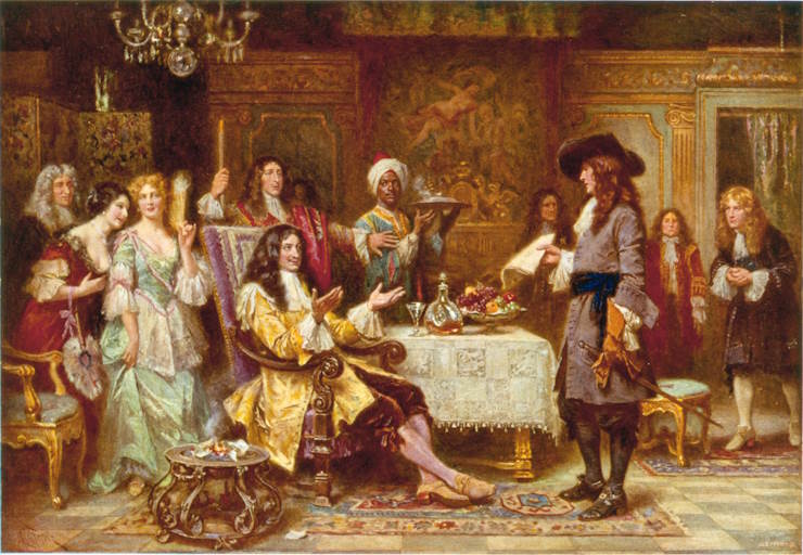
The Penns, a Quaker family, were granted theirs by Charles II in 1681. Pennsylvania, the state that still bears their name, was the land extending westwards from the Delaware River, “five degrees in longitude” and “bounded on the North, by the beginning of the three and fortieth degree of Northern latitude, and on the south, by a circle drawne at twelve miles distance from [the town of] New Castle”; “by a straight line Westwards, to the limits of Longitude above mentioned”, extending “along the fortieth degree north parallel of latitude.” The dispute arose from conflicting claims to the territory westward from the Delaware River.
To begin with, even though no one was exactly sure where the boundary lay between the two states, there was little friction. There was sufficient land for all, and the settlers were on good terms with their indigenous neighbours, the original tribes of the region. But as more new colonisers arrived, disputes began over which state the new arrivals were in. These disputes became violent and there were notorious massacres of peaceable tribes in the region by mounted gangs, which outraged many of the settlers who had established good relationships with the tribes.
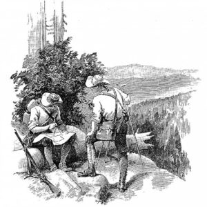
Mason and Dixon had proved their mettle on the voyage to observe the transit. They were hired to carry out a survey to settle the dispute once and for all. With Mason taking complex measurements of the celestial sphere, and Dixon translating his measurements to lines on the earth’s surface, the two experienced surveyors travelled along the line whatever the terrain, over hills and down valleys, hacking their way whenever necessary, measuring, calibrating, and recalibrating.
They were carrying with them delicate instruments created by John Bird, Dixon’s mentor. These included a zenith sector or zenith telescope, safely cushioned on a pillow as they journeyed with packhorses across the terrain. An equal altitude measure was used for observing objects at lower levels.
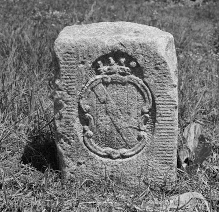
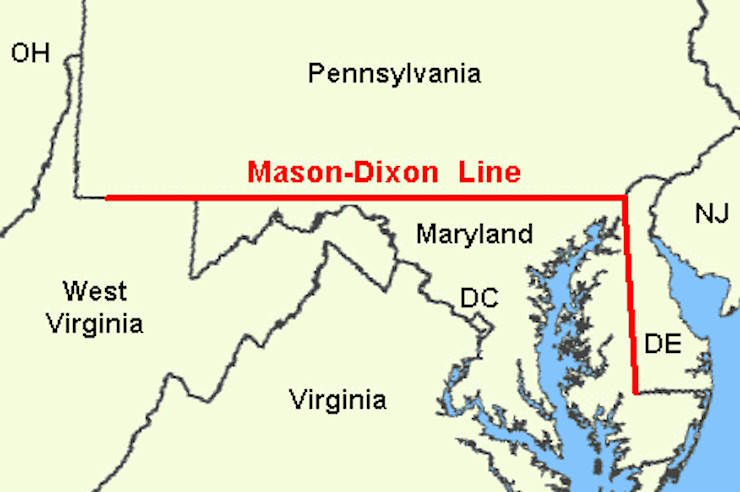
With their combination of determination, experience, and superb instrumentation, Mason and Dixon laid out not just one line, but two. The first was along the 83-mile (133.5 km) north-south division between Maryland and Delaware. This was known as the Tangent Line. The longer line ran for 233 miles (375 km) from east to west, marking the correct demarcation between Pennsylvania and Maryland, and was known as the West Line. It is not hard to imagine them progressing with utter determination, turning an imaginary line identified by celestial measurements and projections into a real one by setting down milestones to mark the boundary, and dealing with all interruptions along the way. Dixon by all accounts was a giant of a man who would have appeared formidable in this semi-wilderness, while the more fashionable Mason was by now a widower with two young sons.
This first geodetic survey of part of America established more than a state boundary line. Long after the two surveyors were dead, the Mason-Dixon line achieved cultural and historic significance for marking the division between the slave states and the free, or free-soil states. The term Mason and Dixon line has been connected to the Missouri Compromise of 1820, in which Missouri was accepted into the union as a slave state, and Maine as a free state. Popularly, the line was believed to separate north and south, and two cultures with distinct attitudes to the enslavement of people.
But Mason and Dixon’s line had not extended to the west of the Ohio River, and so the application of the free-state versus slave-state description did not apply to all areas of territory to the west. Nonetheless, the idea that somehow the Mason-Dixon divided free and slave states, and north and south, persisted and still appears in some narratives. There is certainly a symbolic and imagined separation, if not a politically and geographically accurate one. The surveyors themselves were asked to settle a boundary dispute. Only later did their line take on figurative significance.
The two surveyors took on a legendary status themselves, with some crediting the term “Dixie Land” or “Dixie” to Jeremiah Dixon. This is controversial term today, representing a mythologised colonial south that means independence and easy-living for some through its association with the confederacy, and exploitation and slavery for others. It’s not certain that the pit engineering lad from County Durham is responsible for this concept though. Another, and perhaps more plausible suggestion is that it comes from a ten (“dix”) dollar note circulated by the New Orleans bank that was used in the south.
However, the Mason-Dixon Line did come to have both actual and figurative importance when the famous Underground Railroad operated, smuggling enslaved people across the boundary to the free states in the north. Many of the people involved were Quakers, and Jeremiah Dixon’s family would surely have approved.
Mason and Dixon appear in popular culture too, notably in Thomas Pynchon’s fantastical (and lengthy) novel Mason and Dixon. They are also the subjects of the Dire Straits song Sailing to Philadelphia which featured Mark Knopfler and James Taylor. Pynchon’s identification of Dixon as a “Geordie lad” is picked up on playfully by Knopfler, who, having grown up in Blyth, Northumberland, would have known better.
Geordies are Tynesiders, who live north of the Tyne, mainly in Newcastle. Had he been called a Geordie in real life, the giant Dixon from Co. Durham would have likely retorted “Aa’m nee Geordie, man!” He might even have called himself somewhat self-deprecatingly “a pit-yacker”, a term for the miners who lived in pit villages. Even tiny parts of the planet like England’s North East still have their linguistic and cultural boundaries!
Dr Miriam Bibby FSA Scot FRHistS is a historian, Egyptologist and archaeologist with a special interest in equine history. Miriam has worked as a museum curator, university academic, editor and heritage management consultant.
Published: 19th February 2024


